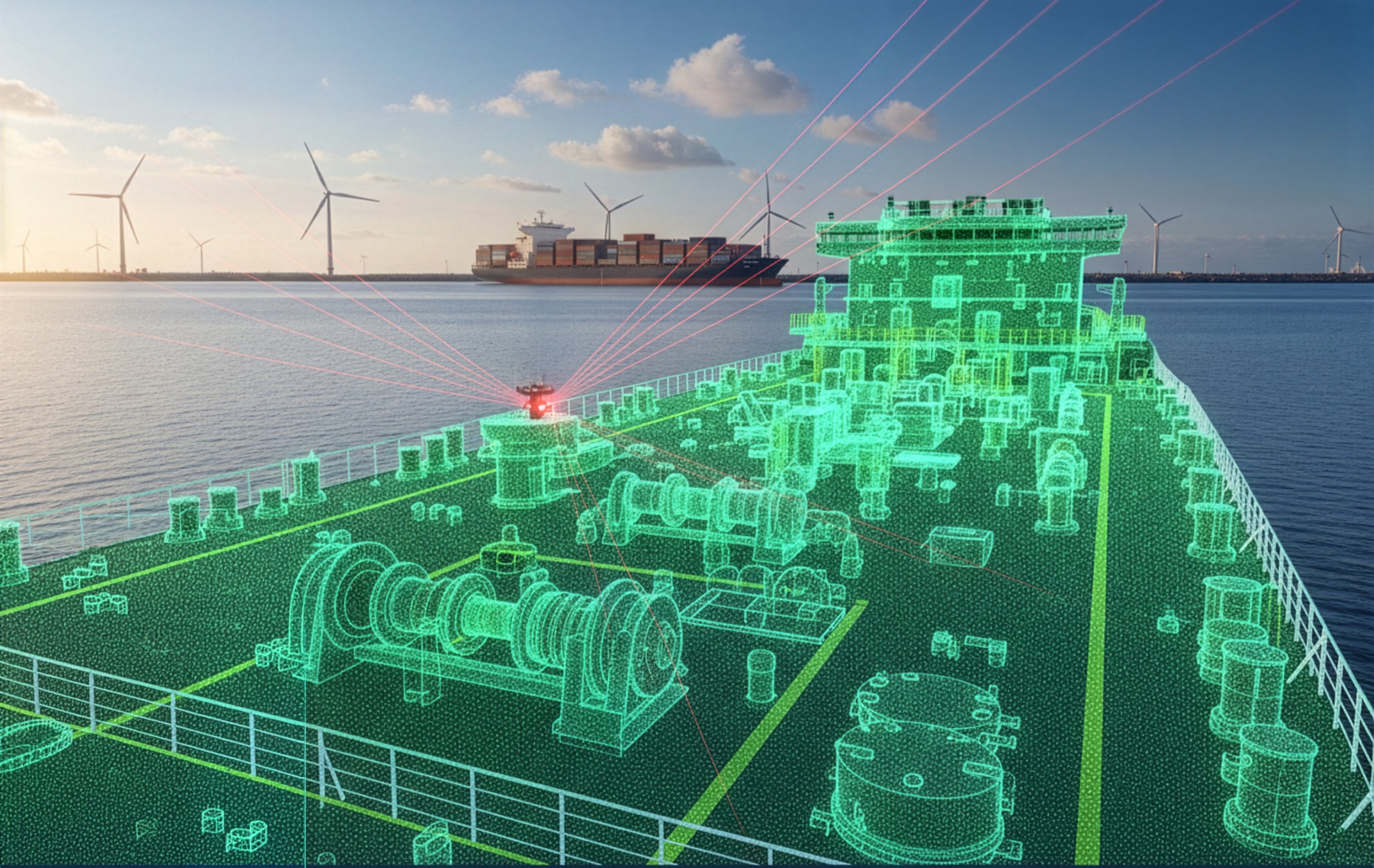
When vessel drawings are obsolete, dry-dock windows are shrinking, and there is zero margin for error. We capture millimeter-precise point clouds that serve as your 'single source of truth,' allowing engineering and maintenance teams to execute with total certainty. By digitizing your most complex maritime assets, we eliminate unnecessary site visits, prevent costly design clashes, and kill the change orders that derail your project & budget.
Marine LIDAR Scanning Services
Why LIDAR for Ships & Shipyards

Reduce rework and change orders
Improve planning accuracy

Enable remote collaboration

Capture as-built conditions with confidence

What Is Marine LIDAR Scanning?
Digital Twin Marine utilizes advanced LiDAR to eliminate guesswork. Whether you need surgical precision for a retrofit or rapid mapping for a fleet-wide digital twin, we deploy the right technology for the mission.
Rapid, non-contact 3D data capture
Ideal for complex, congested shipboard environments
Minimal operational disruption
Static Terrestrial Scanning:
Precision for Retrofits
For complex engineering where every millimeter counts. We capture high-density point clouds to eliminate design clashes before fabrication begins.
Engine rooms, pump rooms, and machinery spaces.
The Goal: Perfect for Ballast Water (BWTS) or Scrubber retrofits where "as-built" accuracy is non-negotiable.
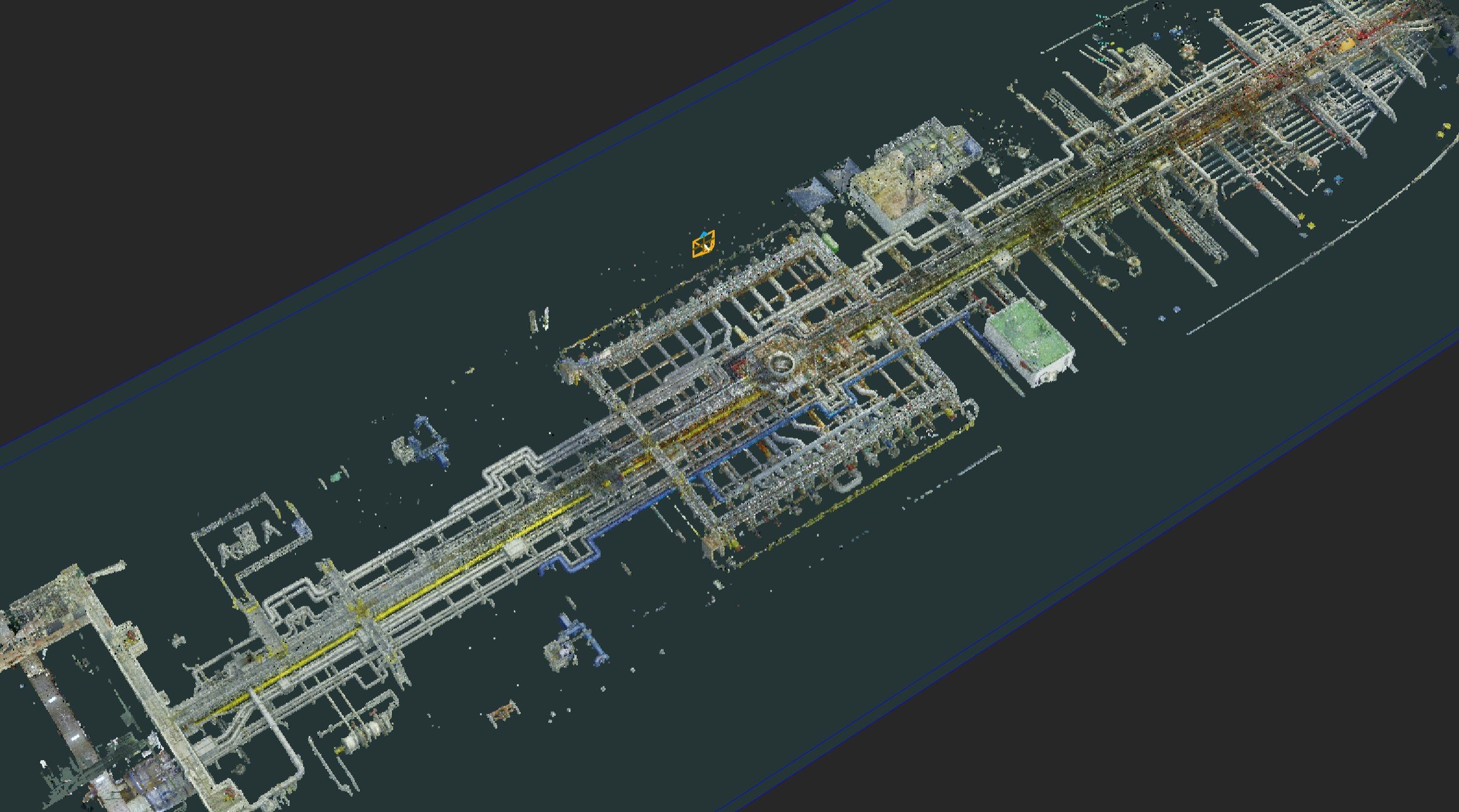
*Rendering from a recent project
Why Terrestrial Scanning Over Mobile SLAM?
While mobile scanning is faster, it often lacks the precision required for complex engineering tasks. Our process prioritizes:
Survey-Grade Accuracy: Essential for retrofitting Ballast Water Treatment Systems (BWTS) or Scrubber installations where every centimeter counts.
Static Stability: By using tripod-mounted terrestrial scanners, we capture crisp, high-resolution data that is free from the motion-blur or positioning errors common in SLAM-based LIDAR.
Interoperability: The resulting data integrates seamlessly into CAD and MBSE workflows, providing a "Single Source of Truth" for engineers and stakeholders.
DTM Deliverables
What to expect…
-
These comprehensive 3D datasets serve as a survey-grade "digital snapshot," providing billions of precise measurement points in industry-standard formats for seamless use in any professional 3D environment.
-
Our data is optimized for cloud-based hosting, enabling global stakeholders to virtually walk through the vessel, manage assets, and access critical maintenance data from any device, anywhere in the world.
Technical
Capabilities
Digital Twin Marine delivers high-fidelity spatial data designed to be the digital backbone of your fleet. We move beyond simple visuals to provide survey-grade accuracy that integrates directly into your existing engineering workflows.
Engineering-Grade Data for the Maritime Industry
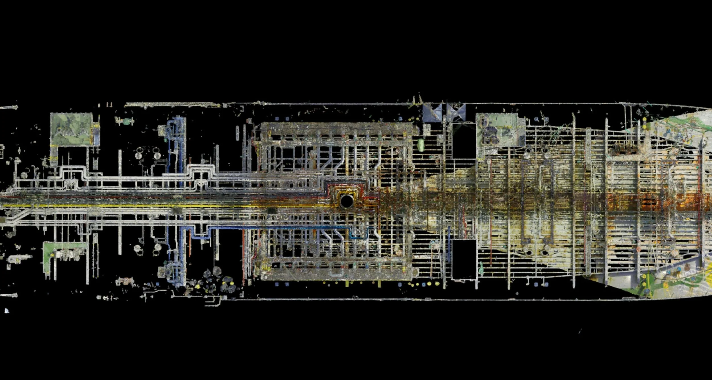
Millimeter Accuracy
We deliver millimeter to sub-centimeter precision tailored to your project’s needs. Whether measuring a pump flange or a cargo hold, our data ensures "first-time-right" engineering, eliminating the margin for error that leads to costly rework.
Our scans generate billions of XYZ data points, creating a high-density "as-built" record. These datasets are fully compatible with CAD and BIM software (AutoCAD, Navisworks, Rhino), allowing shoreside teams to perform clash detection and design with total confidence.
Dense, Engineering-Ready Point Clouds
Vessel Coordinate System Registration
We don't provide "floating" data. Every scan is registered to the Vessel Coordinate System (VCS), aligning perfectly with the ship’s centerline and frame stations. This global consistency allows you to overlay original blueprints directly against current physical conditions.

LIDAR + Digital Twins
The Standalone Power of LiDAR
As a standalone service, LiDAR provides immediate, high-impact value. It is the definitive solution for as-built verification, allowing owners and shipyards to capture a vessel's current state with millimeter precision. In an industry where original drawings are often outdated or lost, a standalone LiDAR scan provides the "ground truth" needed for safe, predictable engineering.
The Building Block for Digital Twins
Beyond a one-time scan, LiDAR is the essential DNA of a Digital Twin Marine ecosystem.
The Structural Layer: It provides the precise geometry upon which all other data is layered—from IoT sensor feeds to maintenance logs.
Scalability: A LiDAR scan is a permanent digital asset. You can start with a single engine room scan for a specific retrofit and later expand that data into a full-vessel digital twin.
Long-Term Lifecycle: While the physical ship ages and undergoes changes, the LiDAR-based Digital Twin remains a live, evolving document that tracks the vessel's entire lifecycle.
Have a Complex Vessel or Shipyard Project?
Our team can help you capture it accurately the first time.